| Author |
 Replies: 341 / Views: 110,825 Replies: 341 / Views: 110,825 |
|
|
|
Bedrock Of The Community
United States
28583 Posts |
|
|
Tunisia 2001 Archaeological Sites and Monuments The Needles of Tabarka are a series of towering crags near the seaside city of Tabarka. The Numidian flysch formation carved by erosion stand up to 20 meters high out into the sea. 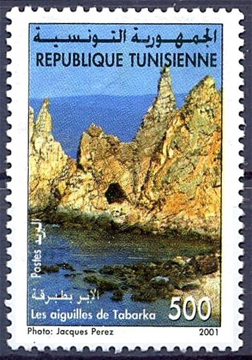 |
Send note to Staff 
|
| Edited by KuoLC5310 - 08/26/2021 08:35 am |
|
|
Bedrock Of The Community
United States
28583 Posts |
|
|
Tunisia 2018 Tourism Midès Canyon is located in western Tunisia, between the Oasis de Midès and a mountain range. The dramatic landscape is created by a river cutting through Tertiary sandstone formations. 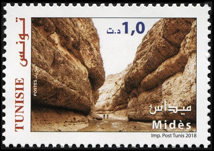 |
|
Send note to Staff
|
|
|
Valued Member
United States
5 Posts |
|
|
Valued Member
United States
5 Posts |
|
|
Valued Member
United States
5 Posts |
|
|
Bedrock Of The Community
United States
28583 Posts |
|
|
Algeria 1980 World Tourism Conference Aurés mountains in eastern Algeria are an eastern extension of the Atlas Mountain System. River-cut landscapes range from valleys with steep cliffs to canyons with talus deposits. Tassili n'Ajjer is a national park located on a vast plateau in the Sahara desert. Erosion in the area has resulted in natural rock arches and columns in the south and deep gorges in the north. 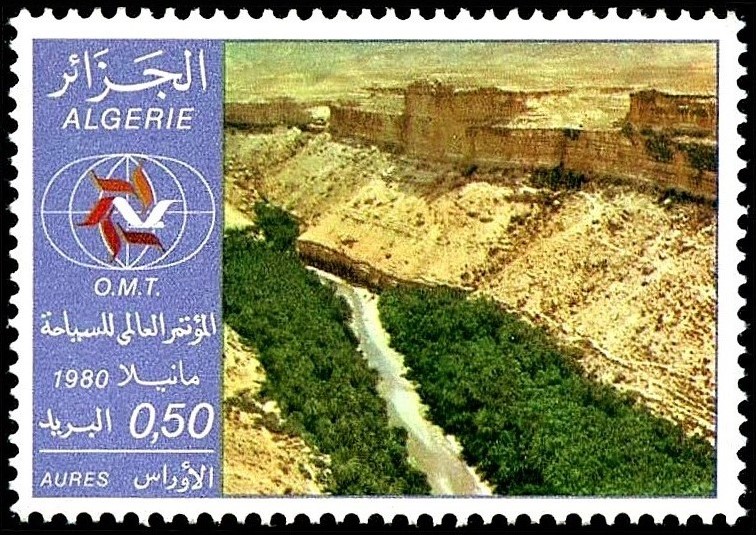 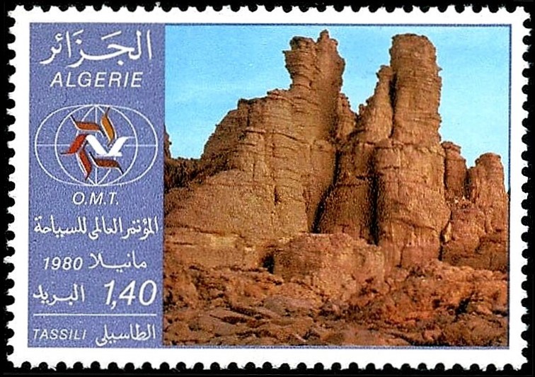 |
|
Send note to Staff
|
|
|
Bedrock Of The Community
United States
28583 Posts |
|
|
Algeria 2001 National Parks Gouraya National Park is located on the Mediterranean coast, north of the city of Bejaia. At the northern end of the park stands Cape Carbon, a piece of the allochthonous Tellian nappe of Mesozoic age. 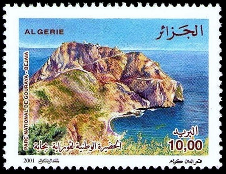 |
|
Send note to Staff
|
|
|
Bedrock Of The Community
United States
28583 Posts |
|
|
Burkina Faso 1991 Rock Formations 20f: Quartzite from Boureli 50f: Granite from Dori 280f: Amphibolite from Bamga 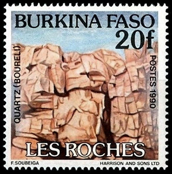 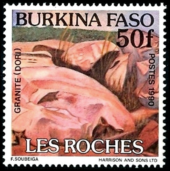 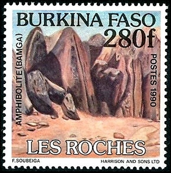 |
|
Send note to Staff
|
|
|
Bedrock Of The Community
United States
28583 Posts |
|
|
Ivory Coast 1999 Ahouakro Rock Formations Archaeological Park of Ahouakro in southern Ivory Coast houses many igneous megaliths dating from the Proterozoic ( ca. 2.3 to 2.1 Billion Years). These rocks have diverse configurations and often are in precarious balance positions. 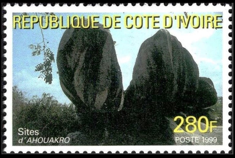 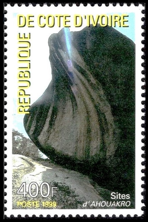 |
|
Send note to Staff
|
|
|
Bedrock Of The Community
United States
28583 Posts |
|
|
Zimbabwe 1991 Commonwealth Heads of Government Meeting Matobo National Park in southwest Zimbabwe is known for the Matobo Hills, a range of balancing rock formations created by erosion of the granite plateau. 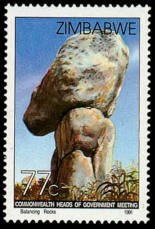 |
|
Send note to Staff
|
|
|
Pillar Of The Community
United States
7239 Posts |
|
|
In October 1947, The French Zone of occupation in Germany issued this 16 pf stamp (Mi #6) as a part of its 15-stamp definitive series for the Rheinland-Pfalz area. Stamp depicts "The Devil's Table", a rock formation in the Dahn Rockland (Ger: Dahner Felsenland) region in southwestern Pfalz. This Devil's Table design was re-used for one stamp in each of the Rheinland-Pfalz's two subsequent definitive series. 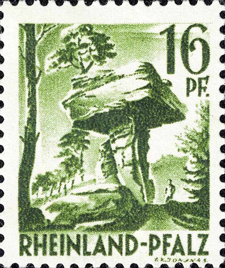 |
|
Send note to Staff
|
|
|
Pillar Of The Community
United States
7239 Posts |
|
|
Here are the February 9, 1989 350 pf values (BRD Mi #1407, Berlin Mi #835) of the Federal Republic of Germany's and Berlin's "Historic Sites and Objects" definitive series. Stamps depict the Ecksternsteine with its human-built footbridge at the top. The Externsteine are tall, sandstone rock formations the Teutoburg Forest in North Rhine-Westphalia. 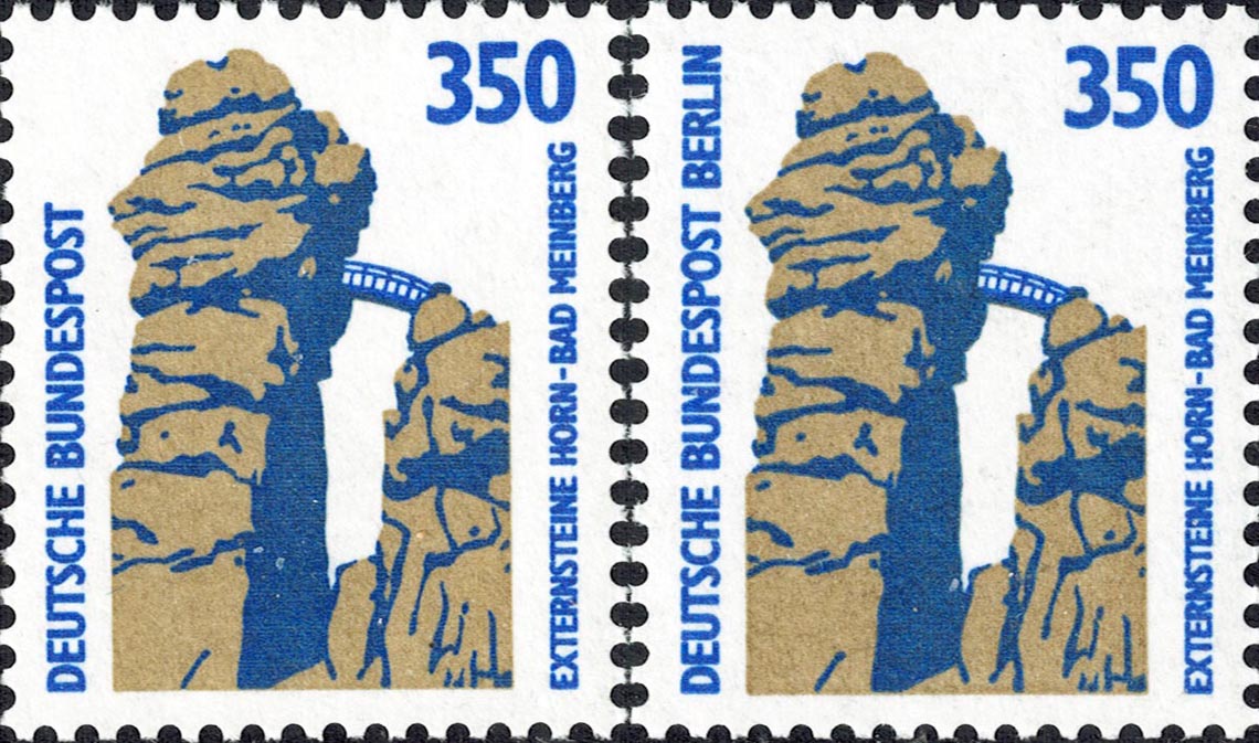 |
|
Send note to Staff
|
|
|
Pillar Of The Community
United States
7239 Posts |
|
|
On July 14, 1994 Germany issued a set of four, 100 pf stamps as part of its 1993-6 "Pictures from Germany" series of 15. All of the stamps of this series have a similar look because they were designed by Heinz Schillinger. One of the stamps from this set, Michel #1743, shows a view of the Ore Mountains (Ger: Erzegebirge) in southern Saxony, bordering Bohemia. From Wikipedia, The area played an important role in contributing Bronze Age ore, and is the setting of the early modern transformation of mining and metallurgy from a craft to a large scale industry, a process that preceded and enabled the later Industrial Revolution." 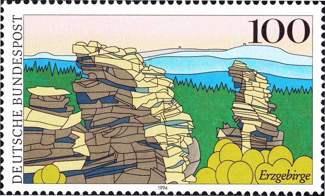 |
|
Send note to Staff
|
|
|
Bedrock Of The Community
United States
28583 Posts |
|
|
South West Africa 1988 Landscapes Sesriem Canyon in central Namibia is carved by Tsauchab River into sedimentary rock formations. It is about one kilometer long and up to 30 meters deep. Hoarusib River in northern Namibia cut through volcanic rocks to form canyons. Also found near the bank are "clay castles" created by the gradual deposition and erosion of clay formation. 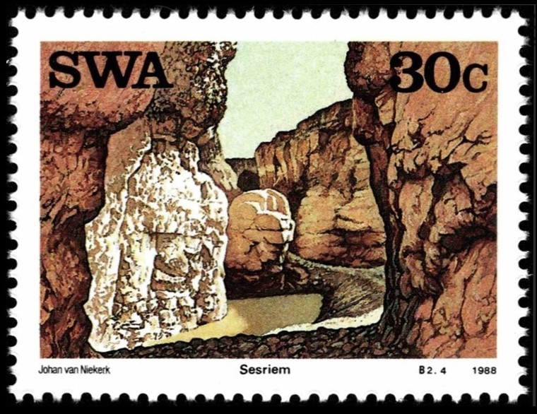 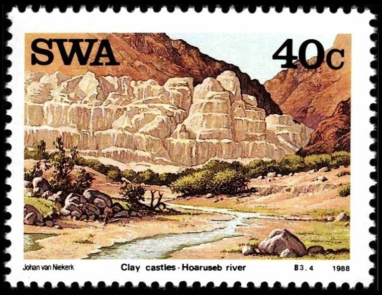 |
|
Send note to Staff
|
| Edited by KuoLC5310 - 09/06/2021 08:54 am |
|
|
Bedrock Of The Community
United States
28583 Posts |
|
|
Namibia 1990 Landscapes Tsaris Mountains features plateaus and canyons created by wind erosion in arid climate. The rock formations of this range are dated to Proterozoic. Dolerite Hills are rock formations of the Keetmanshoop Dolerite Complex, which is associated with the break-up of the Gondwana Supercontinent started 180 million years ago. 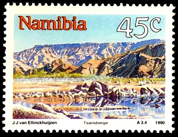 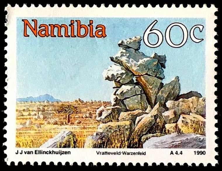 |
|
Send note to Staff
|
|
|
Replies: 341 / Views: 110,825 |
|