| Author |
 Replies: 395 / Views: 73,295 Replies: 395 / Views: 73,295 |
|
|
|
Bedrock Of The Community
Australia
38679 Posts |
|
|
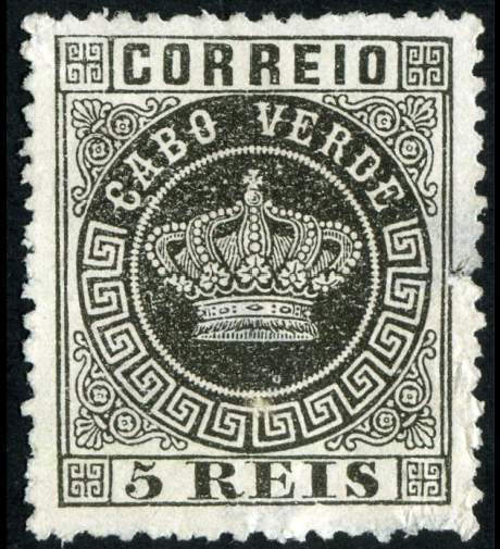
Hey! I must have missed this post before... Thanks Steve  A new issue for my "Insulators" on stamps..wow |
Send note to Staff 
|
|
|
Bedrock Of The Community
Australia
38679 Posts |
|
|
Pillar Of The Community
Australia
1927 Posts |
|
|
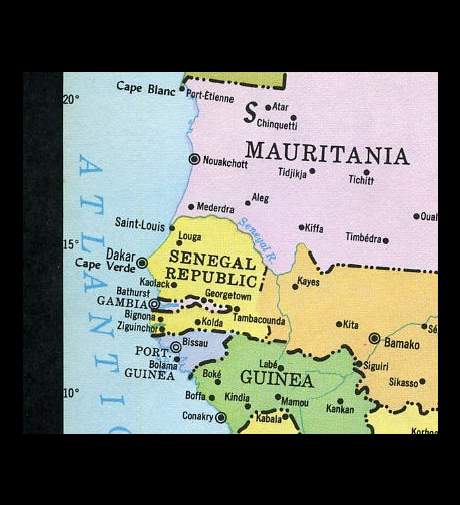
Keep those pics coming. Thanks, Rod, now I know where Cape Verde is. Steve  |
|
Send note to Staff
|
|
|
Pillar Of The Community
United States
4106 Posts |
|
|
Rest in Peace
United States
519 Posts |
|
|
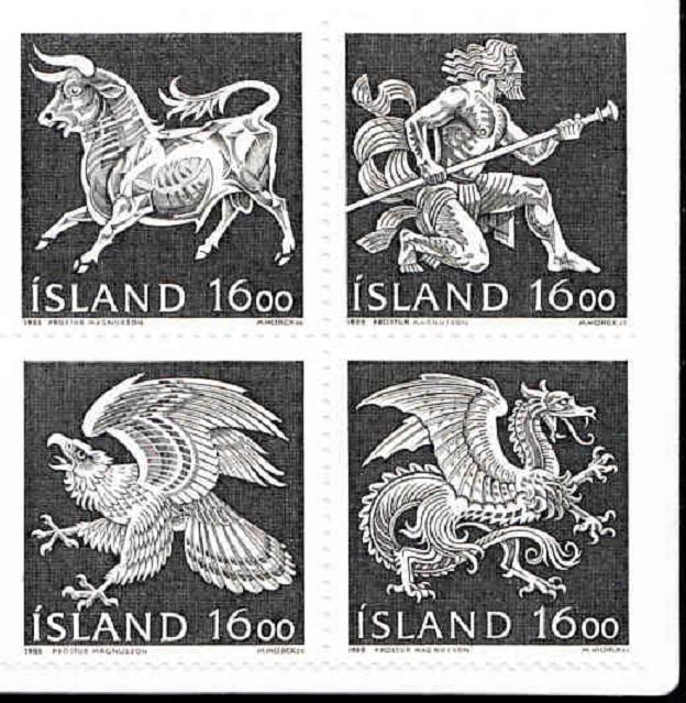
These are really, really neat. In my photography hobby I am increasingly using black and white (even film) because the effects are just more dramatic than color. Now I have to start another stamp theme collection (sigh). |
|
Send note to Staff
|
|
|
Pillar Of The Community
Canada
2574 Posts |
|
|
Pillar Of The Community
United Kingdom
3214 Posts |
|
|
Hi rod222, Nice map but it shows the cape called Cape Verde (or Cap Vert) not the country which a group of islands about 350 miles west of the cape.
edited - I originally said the islands were east of the cape! |
|
Send note to Staff
|
| Edited by nigelc - 09/11/2010 11:28 am |
|
|
Pillar Of The Community
Canada
2574 Posts |
|
|
nigel
Cap-Vert is the french name. Cabo Verde in portuguese. Cape Verde is also use in english but it's all the same group of islands. |
|
Send note to Staff
|
|
|
Pillar Of The Community
United Kingdom
3214 Posts |
|
|
Quote:
nigel
Cap-Vert is the french name. Cabo Verde in portuguese. Cape Verde is also use in english but it's all the same group of islands.
Hi timbres667, I think you've misunderstood my point. There's a cape in Senegal called Cape Verde / Cap Vert / Cabo Verde etc. which is shown on the map here and there is also an independent country (and former Portuguese colony) with the same name which is a group of islands in the Atlantic. These two Cape Verdes are about 350 miles apart. The map shows the cape but does not show the islands. |
|
Send note to Staff
|
|
|
Rest in Peace
Canada
6750 Posts |
|
|
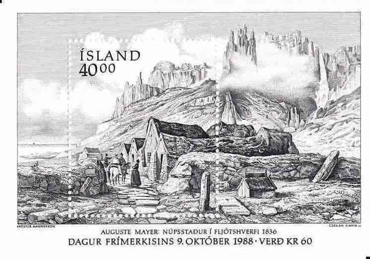
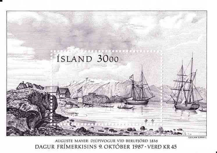
Amazing Iceland souvenir sheets. Republic of Cape Verde, 570 kilometres off the coast of Western Africa: http://en.wikipedia.org/wiki/Cape_VerdeI wonder, if there is a similarly named street on the Cape Verde and in Cape Verde, if the mails get delivered to the wrong country sometimes? Used to happen here with similarly named streets just across the harbour. |
|
Send note to Staff
|
|
|
Pillar Of The Community
Canada
2574 Posts |
|
|
nigelc you're completely right. The map in rod post doesn't show the islands of Cape Verde but the cape in Sénégal. Ahhh! Cap-Vert the country of Cesaria Evora. I wonder if there is a stamp about her. Got to hear her beautiful voice again. |
|
Send note to Staff
|
|
|
Valued Member
United States
20 Posts |
|
|
Thanks for bringing this post back to life. I have really enjoyed going through each page and seeing some GREAT looking stamps. Keep them coming! |
|
Send note to Staff
|
|
|
Bedrock Of The Community
Australia
38679 Posts |
|
|
Quote:
if the mails get delivered to the wrong country sometimes?
I once posted some stamps to the late Mette Heindorff in Denmark. Posting them from my Perth West Aussie location, the package went first to Denmark, a town in the South of Western Australia before heading overseas. ( someone sorted prior to their morning coffee  ) Denmark Western Australia (bottom of map) 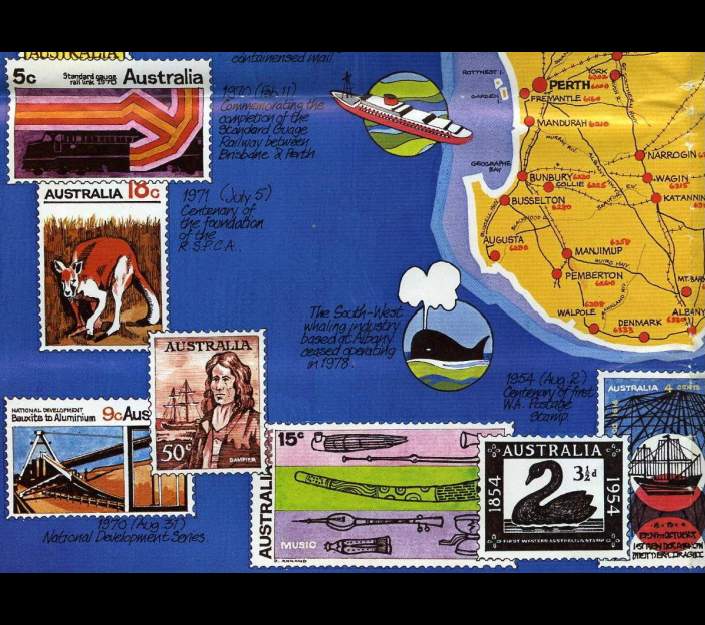 |
|
Send note to Staff
|
| Edited by rod222 - 09/11/2010 7:13 pm |
|
|
Rest in Peace
Canada
6750 Posts |
|
|
A couple on holidays from somewhere in Europe recently arrived in Sydney, Nova Scotia, Canada, a friendly cola (oops) coal mining town down in Cape Breton Island.
They were a bit surprised when they got off the plane as they had expected to be in Sydney, Australia. This rerouting has happen before too. |
|
Send note to Staff
|
| Edited by Puzzler - 09/11/2010 8:27 pm |
|
|
Bedrock Of The Community
Australia
38679 Posts |
|
|
That's an interesting observation, as an English speaker
Cape Verde Islands suggests a group of Islands nestling
in Cape Verde, or in the near vicinity, I saw nothing wrong
with the map ( a childs school atlas) and the Cape that
gave the name to the Islands. The aim was to locate their general position.
Being as they are so far away, I think it's a valid point to raise.
In the days of Henry the navigator, the name I suspect was
quite pertinent to sailors in caravels heading south as a reference point.
As a modern name and being 570 Km off the coast, that is some stretch.
|
|
Send note to Staff
|
|
|
Replies: 395 / Views: 73,295 |
|