Quote:
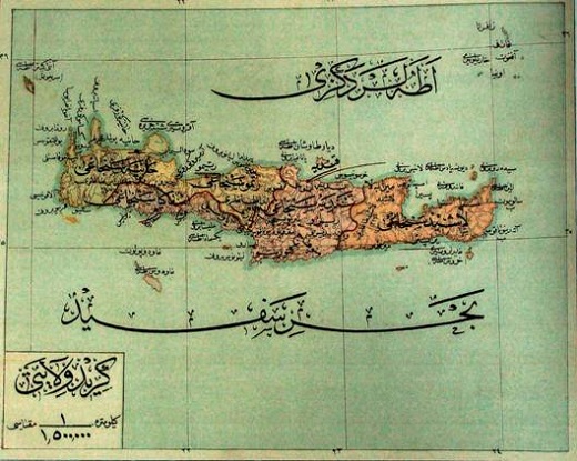
I believe the Ottoman name Girit (Crete) is the long word running below the island.
The name of the map is in the bottom left corner
"Girit Vilayeti" and the ratio size is 1/1500000 of a kilometer (not sure if that is for 1 centimeter on the map)
The island was divided into five "sanjagi" (districts) named after their chief towns. Sanjaks were introduces as part of an overhaul of local government in the Empirein 1876, so the map is from somewhere between 1876 and 1898.
The 5 districts, from west to east, were :
Khaniya
Isfakiya (on south coast)
Rismu
Qandiya (the main city, but on map the sanjak has a different name, can not make it out though.)
Lashid
The long inscription under the island is "Bahr-I Safid" (Mediterranean Sea in Ottoman Turkish) while above the island is "Adalar Denizi" (Aegean Sea in Ottoman Turkish).