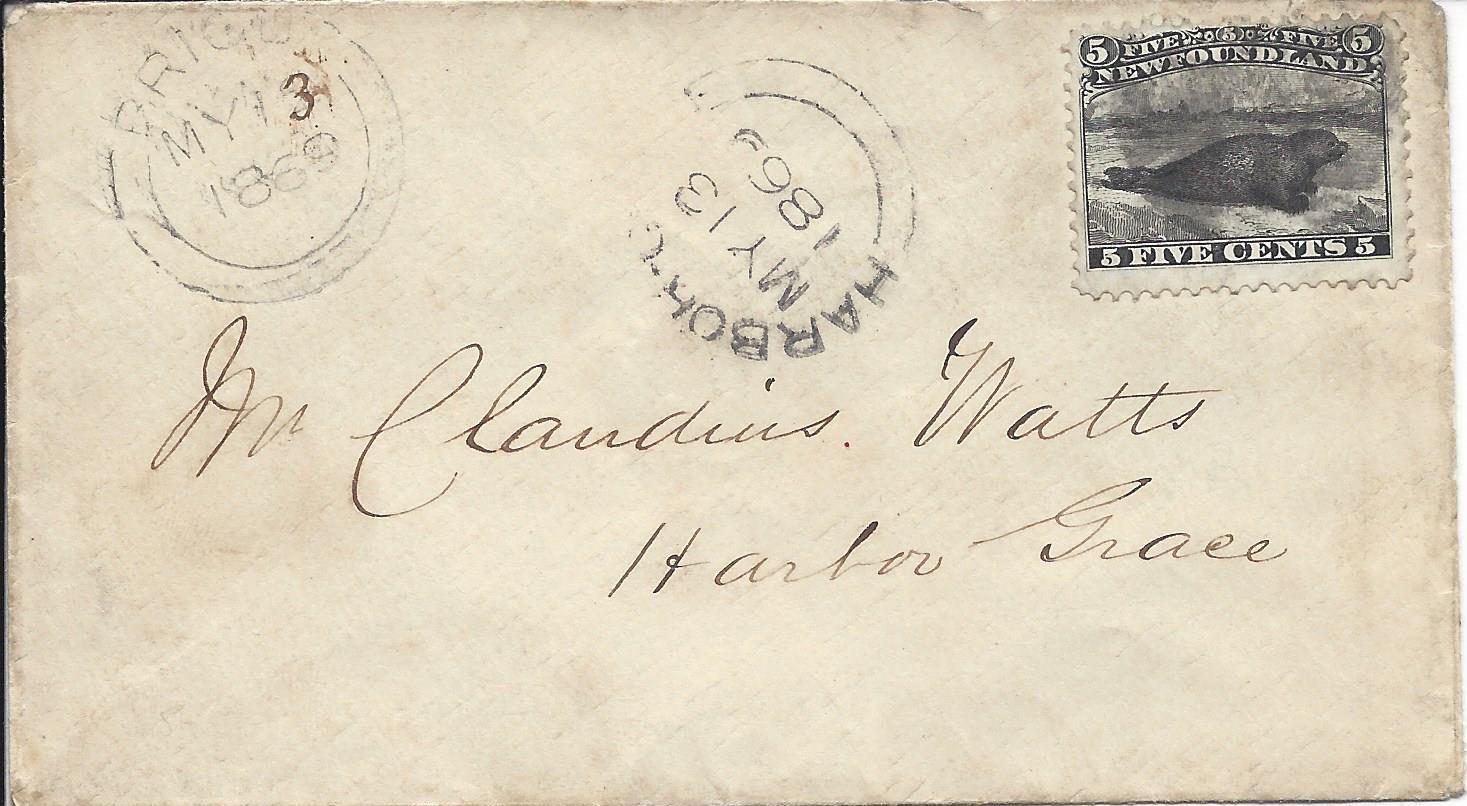
I do not collect Newfoundland, but this cover caught my attention as a general postal history question and a matter of knowing how mail was transported between offices - and St John's in particular. I have no idea in the case of this cover, but two general scenarios come to mind. Let's open the can of worms and see how it plays out.
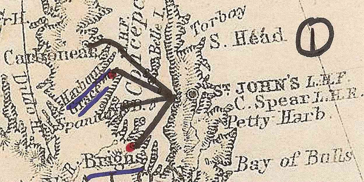
Scenario 1: The major city (St John's, in this case) acts as a sorting and transportation hub with spokes going out to each nearby smaller post office with a round-trip each day. (I doubt this scenario, btw.)
Scenario 2: The major city has only a few routes, each serving several smaller offices in each direction. I could see mail sorted in St John's each night, the boats leave each morning. One boat leaves toward the SW going to Brigus and then northward passing through several ports including Harbour Grace, etc., before returning (perhaps by the reverse route) in the evening to St John's. This letter was posted early in the morning at Brigus and caught the mailboat north and was left at Harbour Grace a few hours later, merely delivered "down the route" never having to go through St John's at all.
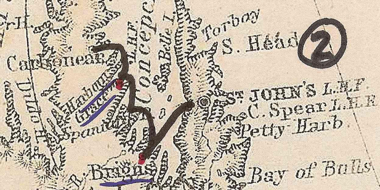
The point being that these two post offices are as close to each other as to St John's, so I believe there is very likely a routing which carried this cover between these two offices and it never went to St John's where it might have received a postmark at an interim location. AND the locals would have known their mail schedules. It would be interesting to plot the geography of covers which DID get a transiting postmark in St John's. Does anyone have any documentation on mail contracts which would detail the transport routes and schedules even better?
(The map is scanned from a c1875 atlas.)





 Posted 03/12/2016 3:15 pm